
ATLANTA —
Quick Forecast:
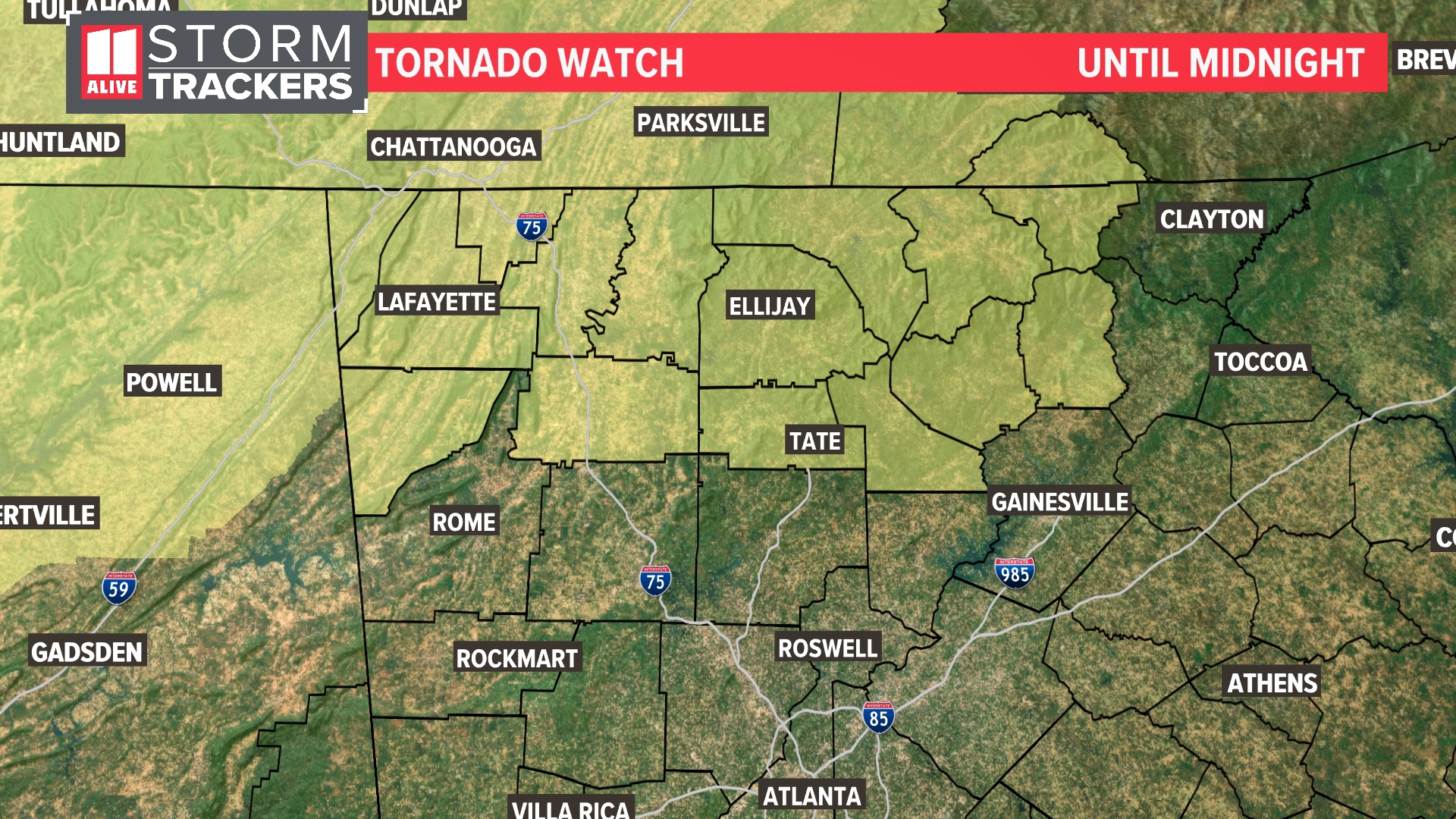
Tonight: Tornado Watch north until Midnight. Showers/storms arrive from the north. Some could be strong to severe. Low: 70°.
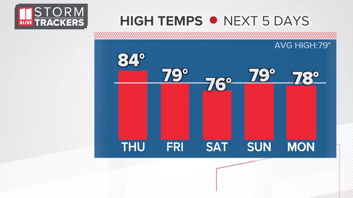
Thursday: Showers and storms likely, especially in the morning. High: 84°.
Thursday Night: Another round of storms possible. Low: 65°
Friday: Storms move out early. Clearing and cooler afternoon. High: 79°.
Discussion:
We are looking ahead to multiple rounds of showers and storms in the coming days. The first round begins to move in around midnight and into the early hours of Thursday morning for far north Georgia.
A Tornado Watch will be in effect until midnight for far north Georgia. This includes the following counties: Dade, Walker, Catoosa, Chattooga, Murray, Whitfield, Fannin, Gilmer, Pickens, Dawson, Towns, and White.

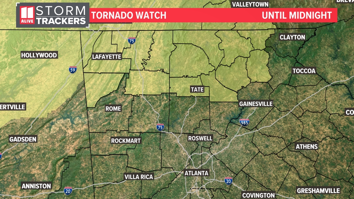
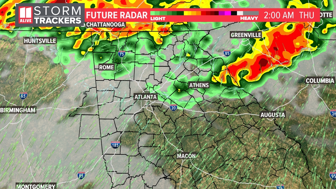
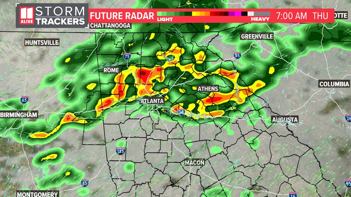
These storms will continue to move to the south throughout the early morning hours, approaching the Atlanta metro before sunrise. Damaging wind, heavy rain and even a brief spin-up tornado could be possible in some storms.

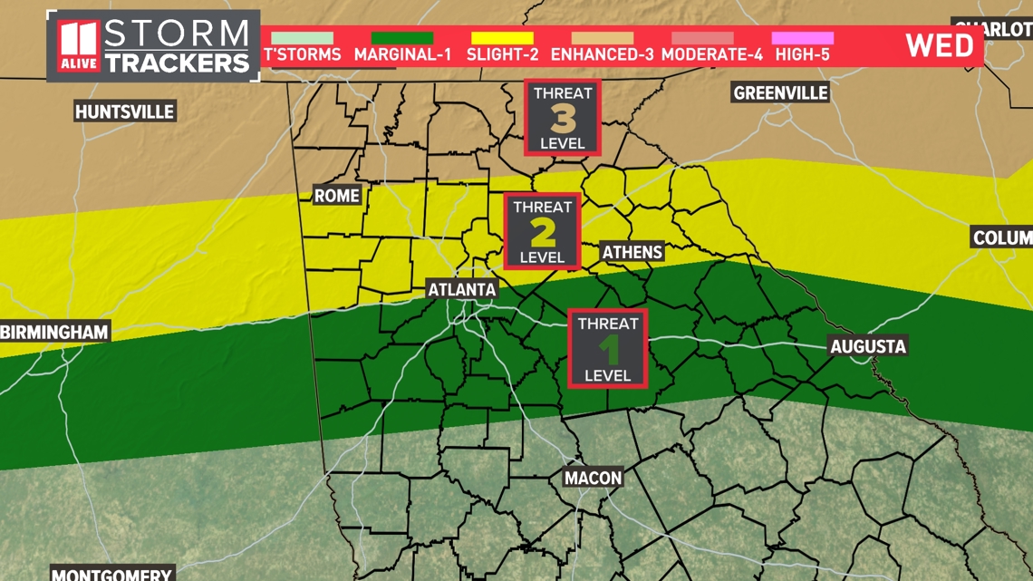
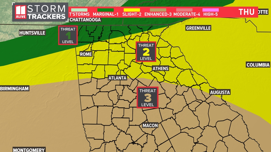
The storms will be strongest into far north Georgia and will likely weaken as they move south. We have a level three out of five risk for severe weather in far north Georgia down to a one out of five risk for spots south of Atlanta.

The main line of storms arrives in the Atlanta area closer to sunrise, which could impact drivers on the morning commute. Make sure you check the forecast before leaving the house in the morning.

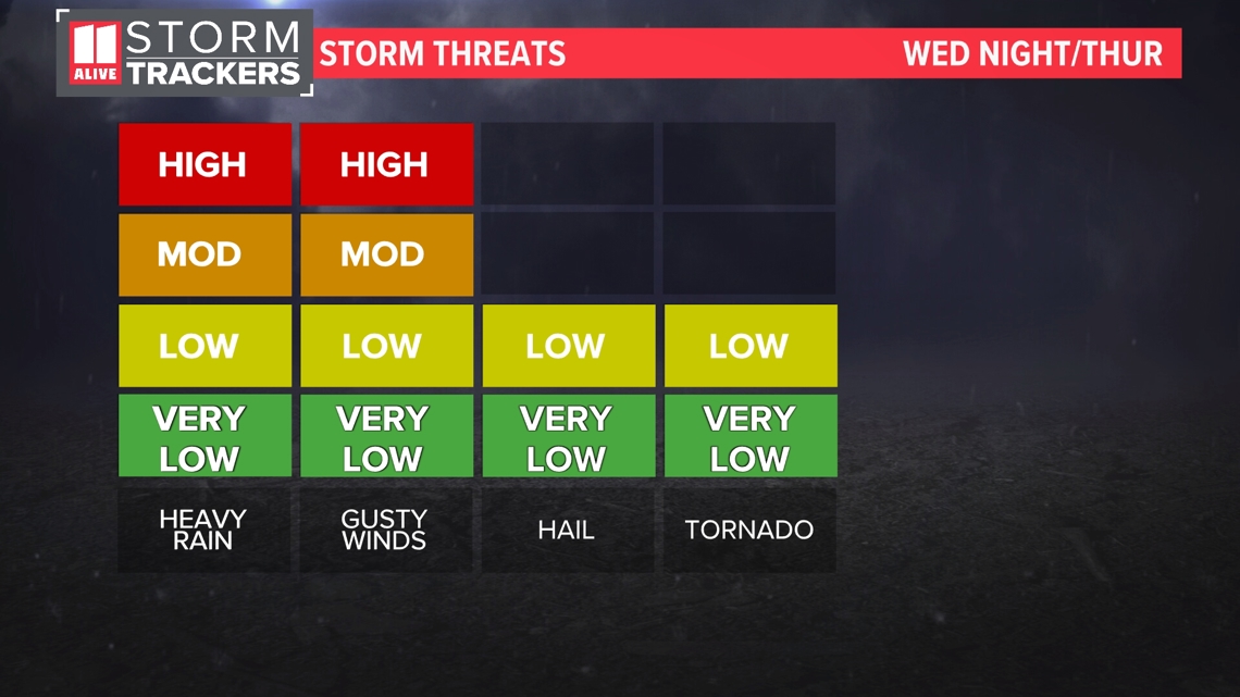
Storms tonight may be capable of producing gusty winds, heavy rain, and hail. The tornado threat is low, but we can't rule out a brief spin-up.

A lull in rain is expected for the middle of the day on Thursday, but a second round of rain could develop and move in later Thursday evening through the overnight and into early Friday morning.

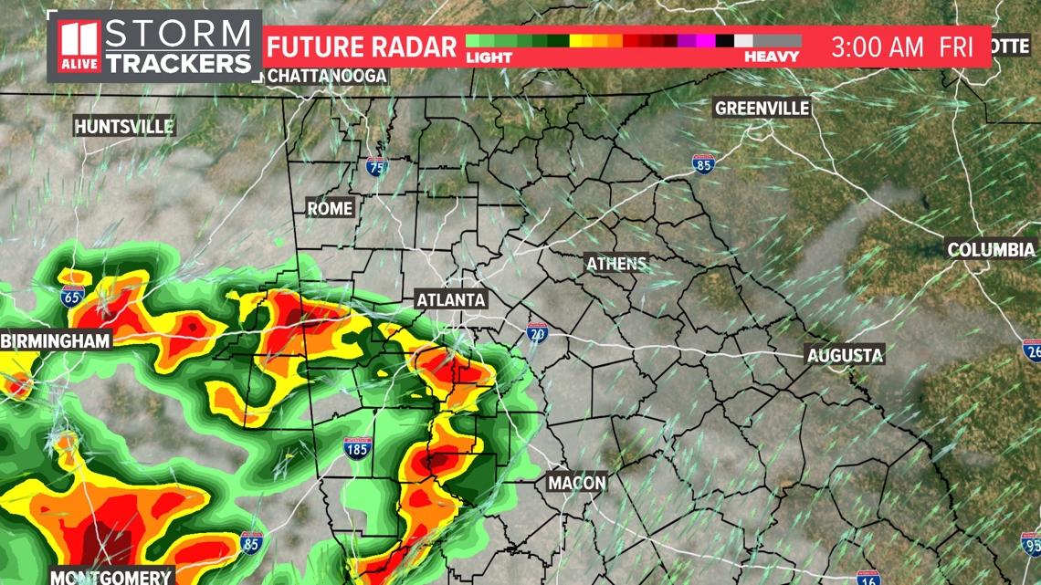
These storms will come with a similar severe weather threat. The Storm Prediction Center has placed Atlanta and points south in a level 3 threat of severe weather.

Rain clears out Friday behind the passing cold front, and cooler, drier air will quickly move in behind it.
Temperatures fall to the 50s for lows and 70s for highs from Saturday through Monday under a mostly sunny to partly cloudy sky each day. This will make for great conditions arriving in time for Mother's Day.
Scattered showers will return back to the forecast on Tuesday and Wednesday with lows in the 60s and highs in the 70s to 80s.

Expect anywhere from one to three inches of rain to occur across north Georgia throughout the next week.
MORE FROM THE 11ALIVE STORMTRACKERS
DOWNLOAD THE 11ALIVE APP:
Set up weather notifications by clicking the Gear icon in the upper right corner of the app. Select Notification -> Notification Settings -> Severe Weather Alerts -> Toggle the Severe Weather Alerts button to the right to turn alerts on.
Send photos and videos through the app by selecting the Near Me feature on the bottom right task bar of the app and entering your information.
TEXT YOUR WEATHER PHOTOS TO US: 404-885-7600
JOIN THE 11ALIVE STORMTRACKERS FACEBOOK GROUP: Nearly 10,000 metro Atlanta and north Georgia weather enthusiasts share their weather photos every day. Click here to join the group!